Study sites in cropland
Study sites in grazing land
Study sites in forests
Basilicata Region Socio-Ecological System (SES)
Editor's note 8Mar13: Source D331-2.2
| Authors: | Agostino Ferrara & Giovanni Quaranta |
| Contributing Authors: | Sofia Bajocco, Antonella De Angelis, Giuseppe Mancino, Alberto Mancini, Francesco Ripullone, Luca Salvati, Rosanna Salvia |
| Editors: | Alexandros Kandelapas, Vassilis Koutsoukos, Jane Brandt |
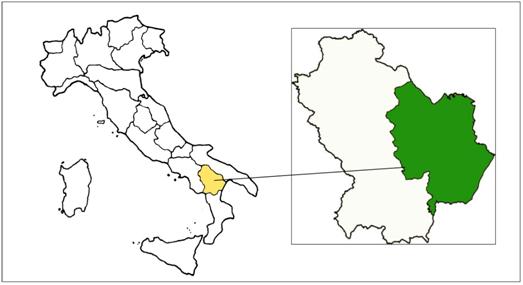 |
Location and population The Matera prefecture study site is Mediterranean coastal and upland area located representing 34% of the total Basilicata Region territory. The Basilicata region is located in the Southern Italy, covering 9,992.24km² and including 131 municipalities. Human settlements are mainly small villages of less than 5000 inhabitants. Population density is about 62 inhabitants/km² (compared to a national average of 195 inhabitants/km²). Urban areas are medium-sized and host only 21,5% of the regional population. |
Topography and hydrology
Basilicata is the steepest region in South Italy: 47% of its area is covered by mountains, 45% is hilly and only 8% corresponds to plains. The western part of Basilicata is crossed by the Apennine Mountains, from North (the Vulture) to South (Pollino and Lagonegrese Mountains), with the highest peaks in the Southern Apennines. The Eastern part of the region is mainly hilly and, because of the lithological structure of the substratum, is continuously altered by soil erosion. The Metaponto plain represents the main flat area of the region. Orographic variability of the region generates a thick hydrographic net; some rivers cross the entire region and flow into the Ionian Sea while others cross partially the Basilicata territory and flow into Tyrrhenian and Adriatic Seas.