Study sites in cropland
Study sites in grazing land
Study sites in forests
Crete Socio-Ecological System (SES)
| Authors: | Constantinos Kosmas, Mina Karamesouti, Thanasis Kizos, Katerina Kounalaki, Minas Metaxakis |
| Editors: | Alexandros Kandelapas, Vassilis Koutsoukos, Jane Brandt |
Editor's note 26Nov12: Source D131-2.2
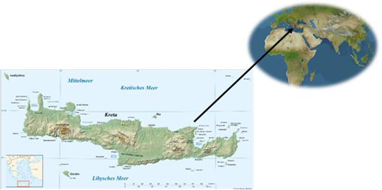 |
Location The region of Crete is bordered to the north by the Sea of Crete and to the south by the Libyan Sea, covering an area of 8336 km². It is divided in four prefectures/ regional units: Chania, Rethymnon, Heraklion and Lassithi, with a total of 24 municipalities. Crete is a rugged mountainous island with high variation in altitude within relatively short distance. |
Climate
The climate of Crete is sub-humid Mediterranean with humid and relatively cold winters, dry and warm summers. However, climate characteristics show great vertical and horizontal spatial variability: distribution of rainfall during the year is highly irregular as is variation of the air temperature. The potential evapotranspiration (ETo) from 948mm to 1640 mm yr-¹.
Soils and topography
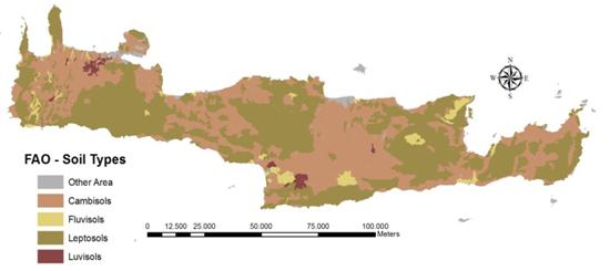
Soils of Crete are generally stony with various contents of rock fragments, a parameter that can have a great but variable effect on soil water conservation and soil erosion, and are characterized as very well drained. Soils are characterized by a variety parent materials such as limestone, shale, marl, conglomerates, flysch and alluvial deposits. Many soils are shallow or subsoil exhibit characteristics adversely affecting biomass production such as bedrock. These characteristics combined with the island’s predominantly steep terrain, contribute to considerable soil erosion problems.
 |
 |
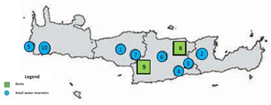
Crete is covered by a dense hydrological network with many water channels. Although due to its dry climate, the island has limited water resources, it has several ponds, natural or not, which constitute also very important wildlife reserves.
 |
 |
Ecosystems and land use
The majority of ecosystems identified in the island of Crete are cultivated (42%), dry lands (39.3%) and mountains (11.7%). Protected areas cover about 45.4% of the island, 91.9% of which are characterized for their unique biodiversity. Based on the CORINE2000 land classification the major land cover types are agricultural areas (olive groves cover 23.3% of the island) and forests and semi-natural areas (Sclerophyllous vegetation covering 23.7%).
Particular LEDD issues in Crete
The main LEDD problems existing in the island of Crete are:
- soil erosion
- soil salinization
- over-exploitation of natural resources related of intensive farming, extensive use of agro-chemicals, expansion of irrigation and the increase in the number of animals grazing the land
- water stress and
- land desertification related to the exhaustion of land productivity, available water reserves and irrational human actions.
The main drivers of land degradation and desertification in Crete include various EU and national policies, the financial markets, climate variability, often exarcerbated by local social structures. Financial support under the CAP has accelerated intensification, specialisation and mechanisation in agriculture. In addition, the significant growth of the tourism sector has place additional strains on land resources.
Land desertification in Crete has adverse environmental and social impacts including reduction in crop production and agricultural income, increase in water deficiency, proliferation of forest fires, loss of biodiversity, land abandonment, changes in micro-climatic conditions, frequent flooding of lowland and migration of population from degraded areas.