Home
Responses to LEDD
Cropland
Grazing land
Forests & shrubland
Study sites
Policy context
Multimedia
17th June
Login
Home
Western Andévalo, Spain
Western Andévalo SES
Soil map
Multimedia
Video Gallery
References
Glossary
Photo gallery
Download documents
Development area
SES parameters
Development area
Editor & Partner login
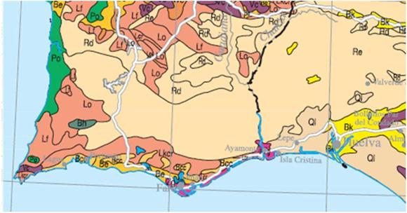
User Name
Password
Remember Me
Forgot your password?
Forgot your username?
Soil map
Views: 22
Return to the gallery
Description: Main soil types in study area, scale 1:2.500.000. Source: Soil Atlas of Europe 2005
Powered by
FW_GALLERY
2014-11-28 11:13:49