Multimedia
Development area
Editor & Partner login
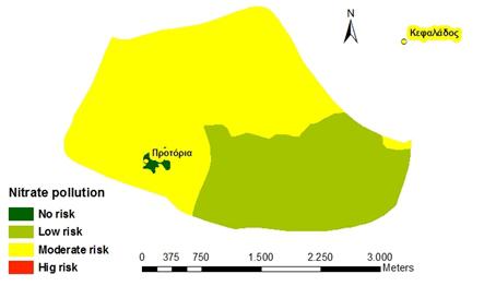
Map of potential groundwater nitrate pollution risk
Views: 59
|
Description: Spatial distribution of potential nitrate pollution risk of groundwater in the Protoria community. Source:(LEDDRA project) |

|
Powered by FW_GALLERY