Multimedia
Development area
Editor & Partner login
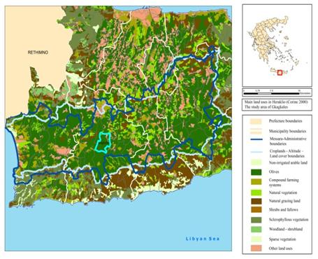
Map of land use 1961 to 2000
Views: 25
|
Description: Main land uses in Gagales from 1961 to 2000. Source: Land use statistics EL.STAT, elaborated by the authors |
|
Powered by FW_GALLERY